The Trans-Canada Highway
Maps from maps.google.com
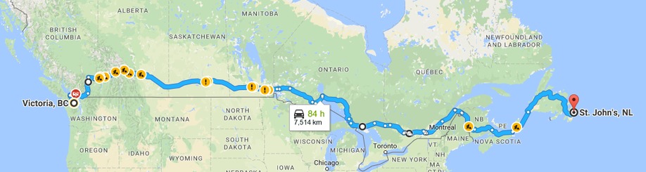
The highway spans the continent from St. John's, Newfoundland to Victoria, British Columbia and was fully completed in the mid-1960s. There are several options of routes across some of the provinces, but we chose to follow the most direct path. The official distance, according to the Trans-Canada Highway website, is nearly 7500 km from end to end along this route, but Google calculates it as slightly over that length. The only province that is not along our route is Prince Edward Island; we'll make a side loop across the Confederation Bridge to include PEI in the project.
There are three northern territories that we are not traveling through on this project, although they are places that we've had on our bucket list of places to visit for ages: Yukon, Northwest Territories, and Nunavut. Labrador, part of Newfoundland & Labrador, is also not on this itinerary, but is a part of the country that we'd dearly love to see and paint. After we finish this project, perhaps we'll have the energy to do Trans-Can Phase II, a tour of Labrador and the territories, but we'll have to put it off for the moment.
Provincial Maps
So you can see exactly where we're going, we've put location markers along the Highway in each province. Click the markers to get a close-up of the location in Google Maps. For those of you with a GPS, the Google Maps are keyed to latitude and longitude coordinates. You can take a look in Google Street View so you can see the spot that inspired our paintings. Be aware, however, that the Google camera car might not have visited some locations for a few years. It's amazing how much Canada can change in a short time!
Newfoundland - St. John's to Port aux Basques

Nova Scotia - North Sydney to Aulac

Prince Edward Island - Wood Islands to Borden-Carleton

New Brunswick - Aulac to Edmunston

Québec - Edmunston to Rigaud

Ontario - Rigaud to Whiteshell
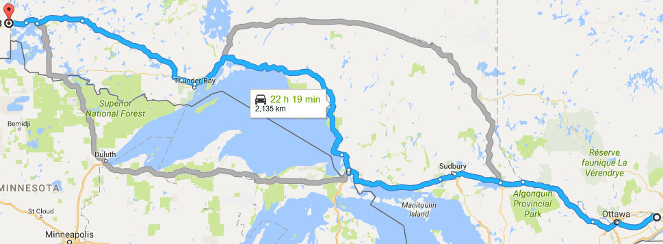
Ontario (East) - Rigaud to Sault Ste. Marie

Ontario (West) - Sault Ste. Marie to Whiteshell

Manitoba - Whiteshell to Fleming

Saskatchewan - Fleming to Cummings Rest Area

Alberta - Cummings Rest Area to Banff National Park

British Columbia - Banff National Park to Victoria

